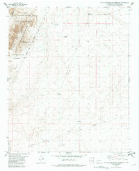
1982 Map of Little San Pascual Mountain
USGS Topo · Published 1982About this map
Little San Pascual Mountains anchor the northwestern corner of this Socorro County landscape, where the high desert terrain meets the eastern edge of the Bosque Del Apache National Wildlife Refuge. The map reveals a land defined by vast ranching boundaries and water management, illustrated by the Pedro Armendaris No 33 grant boundary and the isolated Bruton Ranch and Slash settlements. These outposts rely on a network of scattered water sources such as Shorty Tank and Bruton North Well.
Find a feature on this map
19 named features on this map. Tap any name to fly to it.
Don’t see what you’re looking for? This feature index may not catch every label — zoom into the map to look around manually.
Map Details
Editions of this 1982 Little San Pascual Mountain Map
This is the sole edition of this map. No revisions or reprints were ever made.
Other maps of this area

1948 · Carthage
USGS Topo · 1:62,500

1948 · Granjean Well
USGS Topo · 1:62,500

1948 · San Antonio
USGS Topo · 1:62,500

1948 · Val Verde
USGS Topo · 1:62,500

1954 · Tularosa
USGS Topo · 1:250,000

1958 · Tularosa
USGS Topo · 1:250,000

1981 · Granjean Well
USGS Topo · 1:24,000
1981 · Blakemore Well
USGS Topo · 1:24,000
1981 · Indian Well Wilderness
USGS Topo · 1:24,000
1981 · Harriet Ranch
USGS Topo · 1:24,000