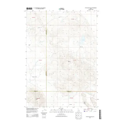
2013 Map of Little Valley Hills
USGS Topo · Published 2013About this map
Little Valley is the primary settlement focal point in this high-altitude landscape where Bonneville, Bingham, and Caribou counties meet. The terrain is defined by a series of distinct plateaus and mountain ridges, including Cranes Flat, Crooked Creek Flat, and Chubb Flat, which are interspersed between prominent elevations like Limerock Mtn and Wilson Ridge. These level flats likely served as key grazing or agricultural areas within the more complex topography of the Little Valley Hills.
Find a feature on this map
29 named features on this map. Tap any name to fly to it.
Don’t see what you’re looking for? This feature index may not catch every label — zoom into the map to look around manually.
Map Details
Editions of this 2013 Little Valley Hills Map
This is the sole edition of this map. No revisions or reprints were ever made.
Other maps of this area

1914 · Henry
USGS Topo · 1:48,000

1915 · Lanes Creek
USGS Topo · 1:62,500

1916 · Henry
USGS Topo · 1:62,500

1917 · Cranes Flat
USGS Topo · 1:62,500

1932 · Irwin
USGS Topo · 1:96,000

1935 · Irwin
USGS Topo · 1:125,000

1955 · Driggs
USGS Topo · 1:250,000

1955 · Preston
USGS Topo · 1:250,000

1958 · Driggs
USGS Topo · 1:250,000

1958 · Preston
USGS Topo · 1:250,000