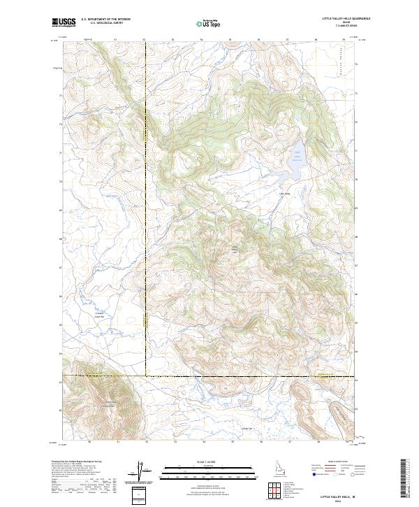
2024 Map of Little Valley Hills
USGS Topo · Published 2024About this map
Little Valley sits at the heart of this high-elevation landscape, where the Little Valley Reservoir manages the local hydrology near the headwaters of Jones Creek and Outlet Valley. The terrain is defined by a series of prominent ridges and flats, including the Little Valley Hills and the southern Wilson Ridge. To the south, the map details the intersection of three counties—Bingham, Bonneville, and Caribou—marking a significant administrative boundary point in the Idaho backcountry.
Find a feature on this map
28 named features on this map. Tap any name to fly to it.
Don’t see what you’re looking for? This feature index may not catch every label — zoom into the map to look around manually.
Map Details
Editions of this 2024 Little Valley Hills Map
This is the sole edition of this map. No revisions or reprints were ever made.
Other maps of this area

1914 · Henry
USGS Topo · 1:48,000

1915 · Lanes Creek
USGS Topo · 1:62,500

1916 · Henry
USGS Topo · 1:62,500

1917 · Cranes Flat
USGS Topo · 1:62,500

1932 · Irwin
USGS Topo · 1:96,000

1935 · Irwin
USGS Topo · 1:125,000

1955 · Driggs
USGS Topo · 1:250,000

1955 · Preston
USGS Topo · 1:250,000

1958 · Driggs
USGS Topo · 1:250,000

1958 · Preston
USGS Topo · 1:250,000