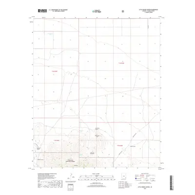
2018 Map of Little Wood Canyon
USGS Topo · Published 2018About this map
The northern slopes of the Chiricahua Mountains dominate this 2018 survey, where the rugged southern terrain within the Coronado National Forest meets the open basins of northern Cochise County. The landscape is defined by dramatic elevation changes at Rattlesnake Point and along the deep drainages of Little Wood Canyon and Emigrant Canyon. Water management in this arid environment is evident through several named catchments, including Government Tank and Roosevelt Tank, as well as the secluded Little Wood Spring. In the lower elevations, isolated routes like S Mulkins Ranch Rd and N Adkins Rd provide the only access through the township and range sections. The map traces the natural transition from the high peaks of Wood Mtn down into the broad canyon floors, providing a clear record of the area's physical geography and modern ranching infrastructure.
Find a feature on this map
19 named features on this map. Tap any name to fly to it.
Don’t see what you’re looking for? This feature index may not catch every label — zoom into the map to look around manually.
Map Details
Editions of this 2018 Little Wood Canyon Map
This is the sole edition of this map. No revisions or reprints were ever made.
Other maps of this area

1917 · San Simon
USGS Topo · 1:125,000

1926 · Cochise Head
USGS Topo · 1:62,500

1926 · Orange Butte
USGS Topo · 1:62,500

1928 · Chenoweth
USGS Topo · 1:62,500

1928 · Bowie
USGS Topo · 1:62,500

1949 · Bowie
USGS Topo · 1:62,500

1950 · San Simon
USGS Topo · 1:62,500

1950 · Bowie
USGS Topo · 1:62,500

1950 · Cochise Head
USGS Topo · 1:62,500

1950 · Vanar
USGS Topo · 1:62,500