
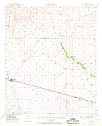
1949 Map of Bowie
USGS Topo · Published 1958About this map
The Southern Pacific railroad corridor anchors the desert landscape of the San Simon Valley, running through the heart of the settlement at Bowie. Surveyed in the late 1940s, this area of Cochise County reflects a rural economy transitioning between cattle ranching and early industrial efforts. Small stations and sidings like Holt and Olga dot the rail line, while the presence of the Yellow Hammer Mill along San Simon Creek indicates local mining or milling activity near the Graham County line.
Find a feature on this map
33 named features on this map. Tap any name to fly to it.
Don’t see what you’re looking for? This feature index may not catch every label — zoom into the map to look around manually.
Map Details
Editions of this 1949 Bowie Map
2 editions found
Other maps of this area

1917 · San Simon
USGS Topo · 1:125,000

1922 · Willcox
USGS Topo · 1:125,000

1926 · Cochise Head
USGS Topo · 1:62,500

1926 · Orange Butte
USGS Topo · 1:62,500

1928 · Chenoweth
USGS Topo · 1:62,500

1928 · Bowie
USGS Topo · 1:62,500

1943 · Dos Cabezas
USGS Topo · 1:62,500

1944 · Fisher Hills
USGS Topo · 1:62,500

1950 · San Simon
USGS Topo · 1:62,500

1950 · Bowie
USGS Topo · 1:62,500