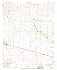
1949 Map of Bowie
USGS Topo · Published 1967About this map
Bowie stands as the primary hub of activity in this desert landscape, situated along the vital Southern Pacific railroad corridor. The area's agricultural and ranching foundations are evident through numerous family-named landmarks like Foote Ranch, Garrett Ranch, and the Posey Ranch (Site). Water management is the defining characteristic of this terrain, with a dense network of infrastructure ranging from Artesian Wells and Windmills to the Charcoal Tank, all supporting life along the San Simon Creek drainage. To the east, industrial history is marked by the Yellow Hammer Mill, while smaller settlements and stops like Holt, Olga, and Karro line the rail tracks. This survey, based on 1940s aerial photography, captures a transitional period in Cochise County's rural development before modern highway expansion altered the traditional ranching routes.
Find a feature on this map
32 named features on this map. Tap any name to fly to it.
Don’t see what you’re looking for? This feature index may not catch every label — zoom into the map to look around manually.
Map Details
Editions of this 1949 Bowie Map
2 editions found
Other maps of this area

1917 · San Simon
USGS Topo · 1:125,000

1922 · Willcox
USGS Topo · 1:125,000

1926 · Cochise Head
USGS Topo · 1:62,500

1926 · Orange Butte
USGS Topo · 1:62,500

1928 · Chenoweth
USGS Topo · 1:62,500

1928 · Bowie
USGS Topo · 1:62,500

1943 · Dos Cabezas
USGS Topo · 1:62,500

1944 · Fisher Hills
USGS Topo · 1:62,500

1949 · Bowie
USGS Topo · 1:62,500

1950 · San Simon
USGS Topo · 1:62,500