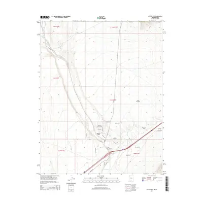
2014 Map of Littlefield
USGS Topo · Published 2014About this map
The Virgin River carves a critical corridor through this corner of the Mojave Desert near the junction of Arizona, Nevada, and Utah. The neighboring communities of Littlefield and Beaver Dam serve as the primary human centers, situated where the river valley widens. This landscape is defined by its drainage systems, including Castle Cliff Wash, Welcome Cr, and the distinctive Figure Four Canyon. Local road networks reveal a mix of long-distance routes like HWY 91 and historically significant paths such as the Spanish Trl and Mormon Flat Rd. Residential growth is evident in the street names of the Beaver Dam area, featuring evocative titles like Clark Gable Dr and Scarlet Ohara Dr. For genealogists, the map identifies both the Littlefield Cem and Beaver Dam Cem, preserving the locations of these early settler burial grounds.
Find a feature on this map
37 named features on this map. Tap any name to fly to it.
Don’t see what you’re looking for? This feature index may not catch every label — zoom into the map to look around manually.
Map Details
Editions of this 2014 Littlefield Map
This is the sole edition of this map. No revisions or reprints were ever made.
Other maps of this area

1885 · St. George
USGS Topo · 1:250,000

1885 · Pioche
USGS Topo · 1:250,000

1886 · Saint Thomas
USGS Topo · 1:250,000

1886 · Mt. Trumbull
USGS Topo · 1:250,000

1886 · Pioche
USGS Topo · 1:250,000

1891 · St. George
USGS Topo · 1:250,000

1892 · Mt. Trumbull
USGS Topo · 1:250,000

1893 · Saint Thomas
USGS Topo · 1:250,000

1953 · Cedar City
USGS Topo · 1:250,000

1953 · Grand Canyon
USGS Topo · 1:250,000