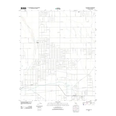
2012 Map of Littlerock
USGS Topo · Published 2012About this map
Littlerock and Pearblossom anchor this high desert landscape, appearing here as established communities defined by a rigid grid of residential streets and agricultural plots. The map captures the significant water management infrastructure of the region, most notably the Governor Edmund G Brown California Aqueduct which traverses the lower portion of the quadrangle. This engineering feat contrasts with the natural, braided drainage patterns of Little Rock Wash and Big Rock Wash, which spill down from the southern mountains toward the desert floor. In the northeast, Alpine Butte rises as a prominent landmark above the surrounding flats. Local administration and services are noted through the presence of the Pearblossom District Ranger Office and several post offices. The layout of roads like E Palmdale Blvd reveals the planned expansion of the Antelope Valley during the early 21st century.
Find a feature on this map
73 named features on this map. Tap any name to fly to it.
Don’t see what you’re looking for? This feature index may not catch every label — zoom into the map to look around manually.
Map Details
Editions of this 2012 Littlerock Map
This is the sole edition of this map. No revisions or reprints were ever made.
Other maps of this area

1900 · Tujunga
USGS Topo · 1:62,500

1901 · Southern California Sheet No. 1
USGS Topo · 1:250,000

1903 · Rock Creek
USGS Topo · 1:62,500

1904 · Southern California Sheet No. 1
USGS Topo · 1:250,000

1915 · Elizabeth Lake
USGS Topo · 1:125,000

1917 · Elizabeth Lake
USGS Topo · 1:125,000

1930 · Lovejoy Springs
USGS Topo · 1:24,000

1930 · Little Rock
USGS Topo · 1:24,000

1930 · Llano
USGS Topo · 1:24,000

1930 · Pearland
USGS Topo · 1:24,000