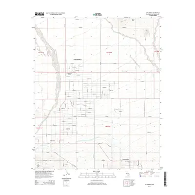
2015 Map of Littlerock
USGS Topo · Published 2015About this map
Palmdale anchors the northern extent of this high-desert landscape in the Antelope Valley, where a highly organized grid of residential and arterial roads like E Palmdale Blvd spreads toward the foothills. The terrain is defined by the striking presence of the San Andreas Fault cutting across the southwestern corner, a geologic feature that shapes the local hydrology and land use. Water management is a central theme of this 2015 study, dominated by the Governor Edmund G Brown East Branch California Aqueduct as it traverses the valley floor near settlements like Littlerock and Pearblossom. Natural features such as Little Rock Wash and Rock Cr provide a contrast to the engineered channels of the Little Rock Ditch, while Alpine Butte stands as a prominent landmark in the northeast, overlooking the desert transition.
Find a feature on this map
62 named features on this map. Tap any name to fly to it.
Don’t see what you’re looking for? This feature index may not catch every label — zoom into the map to look around manually.
Map Details
Editions of this 2015 Littlerock Map
This is the sole edition of this map. No revisions or reprints were ever made.
Other maps of this area

1900 · Tujunga
USGS Topo · 1:62,500

1901 · Southern California Sheet No. 1
USGS Topo · 1:250,000

1903 · Rock Creek
USGS Topo · 1:62,500

1904 · Southern California Sheet No. 1
USGS Topo · 1:250,000

1915 · Elizabeth Lake
USGS Topo · 1:125,000

1917 · Elizabeth Lake
USGS Topo · 1:125,000

1930 · Lovejoy Springs
USGS Topo · 1:24,000

1930 · Little Rock
USGS Topo · 1:24,000

1930 · Llano
USGS Topo · 1:24,000

1930 · Pearland
USGS Topo · 1:24,000