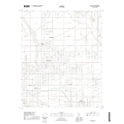
2018 Map of Littlerock
USGS Topo · Published 2018About this map
The San Andreas Fault cuts across the southern landscape of the high desert, defining the geomorphology of this Los Angeles County region. In this 2018 survey, the grid-like residential development of Palmdale and Sun Village contrasts sharply with the arid open space. Vital water infrastructure is visible throughout the area, including the Governor Edmund G Brown East Branch California Aqueduct and the historical Little Rock Ditch. These man-made channels support the communities of Littlerock and Pearblossom, which are situated at the foot of the mountains. The northern portion of the map is dominated by the Alpine Butte landform and seasonal drainage patterns like Rock Creek, illustrating the environmental challenges and engineering solutions inherent to settling the Antelope Valley.
Find a feature on this map
76 named features on this map. Tap any name to fly to it.
Don’t see what you’re looking for? This feature index may not catch every label — zoom into the map to look around manually.
Map Details
Editions of this 2018 Littlerock Map
This is the sole edition of this map. No revisions or reprints were ever made.
Other maps of this area

1900 · Tujunga
USGS Topo · 1:62,500

1901 · Southern California Sheet No. 1
USGS Topo · 1:250,000

1903 · Rock Creek
USGS Topo · 1:62,500

1904 · Southern California Sheet No. 1
USGS Topo · 1:250,000

1915 · Elizabeth Lake
USGS Topo · 1:125,000

1917 · Elizabeth Lake
USGS Topo · 1:125,000

1930 · Lovejoy Springs
USGS Topo · 1:24,000

1930 · Little Rock
USGS Topo · 1:24,000

1930 · Llano
USGS Topo · 1:24,000

1930 · Pearland
USGS Topo · 1:24,000