2021 Map of Littlerock
USGS Topo · Published 2021About this map
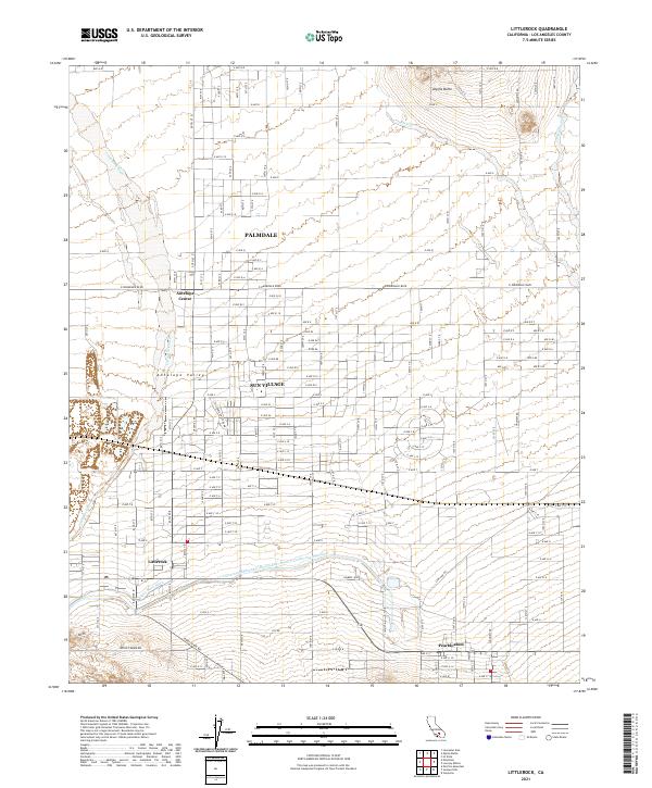
The high desert landscape of the Antelope Valley is defined by a grid of agricultural and residential development punctuated by dramatic natural landmarks like Alpine Butte. This 2021 record shows the modern infrastructure of Los Angeles County, most notably the path of the Governor Edmund G Brown East Branch California Aqueduct as it moves water through the arid region. The map captures the interface between the growing city of Palmdale and the smaller communities of Sun Village, Littlerock, and Pearblossom. Water management is central to the area's history, evidenced by features such as the Little Rock Ditch and the wide, sandy paths of Little Rock Wash and Big Rock Wash which channel seasonal runoff from the mountains to the south. Smaller hubs like Antelope Center anchor the northern reaches of this desert expanse.
Find a feature on this map
83 named features on this map. Tap any name to fly to it.
Don’t see what you’re looking for? This feature index may not catch every label — zoom into the map to look around manually.
Map Details
Editions of this 2021 Littlerock Map
This is the sole edition of this map. No revisions or reprints were ever made.