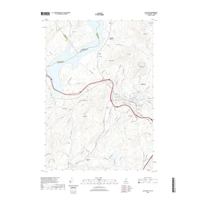
2018 Map of Littleton
USGS Topo · Published 2018About this map
The Ammonoosuc River carves a central path through this terrain, anchoring the settlement of Littleton and its surrounding hill country. High-elevation landmarks such as Walker Mtn and Wheeler Hill overlook a landscape shaped by water management, notably the massive Moore Reservoir to the north and local utilities like Oak Hill Reservoir. For those tracing local families, the map is punctuated by numerous burial sites, including the North Littleton Cem, Pike Cem, and Saint Rose Cem. The presence of the Crazy Horse Campground and the small communities at Slate Ledge and Barrett highlight the mix of recreational and residential land use near the Vermont-New Hampshire state line.
Find a feature on this map
97 named features on this map. Tap any name to fly to it.
Don’t see what you’re looking for? This feature index may not catch every label — zoom into the map to look around manually.
Map Details
Editions of this 2018 Littleton Map
This is the sole edition of this map. No revisions or reprints were ever made.
Other maps of this area

1900 · Whitefield
USGS Topo · 1:62,500

1929 · Moosilauke
USGS Topo · 1:62,500

1929 · Franconia
USGS Topo · 1:62,500

1931 · Littleton
USGS Topo · 1:62,500

1932 · Franconia
USGS Topo · 1:62,500

1932 · Littleton
USGS Topo · 1:48,000

1932 · Moosilauke
USGS Topo · 1:62,500

1935 · Littleton
USGS Topo · 1:62,500

1935 · Whitefield
USGS Topo · 1:48,000

1938 · Whitefield
USGS Topo · 1:62,500