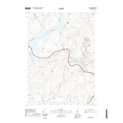
2021 Map of Littleton
USGS Topo · Published 2021About this map
The Connecticut River and Ammonoosuc River define the local geography at this border between New Hampshire and Vermont. The town center of Littleton is the primary hub, where residential streets like Meadow St and Riverside Dr cluster near the river bends. To the north, the massive Moore Reservoir creates a significant water boundary, while the small settlement of North Littleton remains a distinct community. Local heritage is preserved in several small burying grounds, including the North Littleton Cem and Saint Rose Cem, alongside family-named landmarks like Pike Cem. The landscape rises toward prominent elevations such as Parker Mtn and Walker Mtn, while industrial footprints are visible near the Ammonoosuc River at Industrial Park Rd. Further south, the community of Barrett sits near the Gale River, showing the continued importance of river-valley settlement patterns in the White Mountains region.
Find a feature on this map
115 named features on this map. Tap any name to fly to it.
Don’t see what you’re looking for? This feature index may not catch every label — zoom into the map to look around manually.
Map Details
Editions of this 2021 Littleton Map
This is the sole edition of this map. No revisions or reprints were ever made.
Other maps of this area

1900 · Whitefield
USGS Topo · 1:62,500

1929 · Moosilauke
USGS Topo · 1:62,500

1929 · Franconia
USGS Topo · 1:62,500

1931 · Littleton
USGS Topo · 1:62,500

1932 · Franconia
USGS Topo · 1:62,500

1932 · Littleton
USGS Topo · 1:48,000

1932 · Moosilauke
USGS Topo · 1:62,500

1935 · Littleton
USGS Topo · 1:62,500

1935 · Whitefield
USGS Topo · 1:48,000

1938 · Whitefield
USGS Topo · 1:62,500