2022 Map of Liverpool
USGS Topo · Published 2022About this map
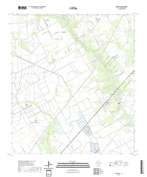
The coastal prairie landscape around Liverpool is defined by the winding course of Chocolate Bayou and a dense network of private airfields. In this modern survey, the intersection of industrial water management and residential development is evident through features like the S Texas Water Company Canal and Bell Lateral, which cut across the terrain to support the region's agricultural and industrial needs. While Alvin marks the northern edge of the sheet, much of the area remains characterized by large tracts of land and specialized facilities, including Songbird Ranch Airport and Toy Airpark. Local history is anchored by the Liverpool Cem, situated near the bends of the bayou. The presence of numerous family-named landmarks, such as Garrett Lake and Garrett Ranch Airport, suggests a continuing legacy of private landownership and rural enterprise in this part of Brazoria County.
Find a feature on this map
94 named features on this map. Tap any name to fly to it.
Don’t see what you’re looking for? This feature index may not catch every label — zoom into the map to look around manually.
Map Details
Editions of this 2022 Liverpool Map
This is the sole edition of this map. No revisions or reprints were ever made.