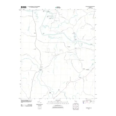
2011 Map of Livingston
USGS Topo · Published 2011About this map
The Coosa River winds through this landscape south of Rome, Georgia, defining the local geography with prominent features like Camp Bend and Turner Bend. This area shows a mix of agricultural tradition and industrial utility, noted by the presence of both the Kraft Industrial Waste Pond Dam and the Heavy Liquor Pond Dam near the riverbanks. Small communities such as Friendship, Foster Mills, and Vans Valley serve as anchors for the surrounding rural network of roads and family-named landmarks.
Find a feature on this map
62 named features on this map. Tap any name to fly to it.
Don’t see what you’re looking for? This feature index may not catch every label — zoom into the map to look around manually.
Map Details
Editions of this 2011 Livingston Map
This is the sole edition of this map. No revisions or reprints were ever made.
Other maps of this area

1886 · Rome
USGS Topo · 1:125,000

1898 · Rome
USGS Topo · 1:125,000

1899 · Rome
USGS Topo · 1:125,000

1904 · Rome
USGS Topo · 1:125,000

1955 · Rome
USGS Topo · 1:250,000

1958 · Rome
USGS Topo · 1:250,000

1961 · Rome
USGS Topo · 1:250,000

1963 · Rome
USGS Topo · 1:250,000
1967 · Rock Mountain
USGS Topo · 1:24,000
1967 · Cedartown West
USGS Topo · 1:24,000