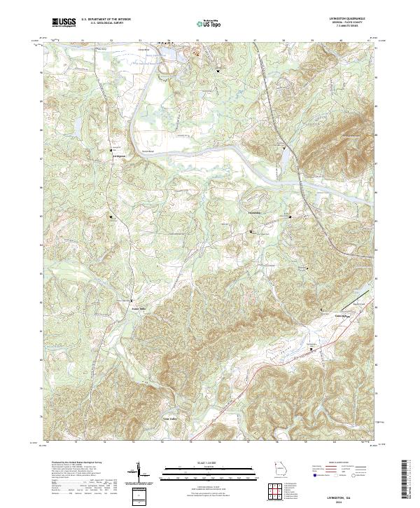
2024 Map of Livingston
USGS Topo · Published 2024About this map
The Coosa River defines the northern reaches of this Floyd County landscape, winding through significant river bends including Camp Bend and Turner Bend. This modern topographic survey highlights a transition from industrial activity near the river—evidenced by the Kraft Industrial Waste Pond and Heavy Liquor Pond—to the agricultural and residential pockets of Livingston and Friendship. The terrain rises sharply toward Horseleg Mountain in the northeast, while the southern portion is characterized by the broad floor of Vans Valley, drained by Webb Creek and Dry Creek. A dense network of local cemeteries, such as Mountain End Lake Cem and Round Hill Cem, offers a detailed spatial record for genealogists and local historians tracking the communities that developed around historic crossroads like Foster Mills and Cunningham.
Find a feature on this map
85 named features on this map. Tap any name to fly to it.
Don’t see what you’re looking for? This feature index may not catch every label — zoom into the map to look around manually.
Map Details
Editions of this 2024 Livingston Map
This is the sole edition of this map. No revisions or reprints were ever made.
Other maps of this area

1886 · Rome
USGS Topo · 1:125,000

1898 · Rome
USGS Topo · 1:125,000

1899 · Rome
USGS Topo · 1:125,000

1904 · Rome
USGS Topo · 1:125,000

1955 · Rome
USGS Topo · 1:250,000

1958 · Rome
USGS Topo · 1:250,000

1961 · Rome
USGS Topo · 1:250,000

1963 · Rome
USGS Topo · 1:250,000
1967 · Rock Mountain
USGS Topo · 1:24,000
1967 · Cedartown West
USGS Topo · 1:24,000