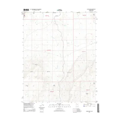
2014 Map of Lizard Point
USGS Topo · Published 2014About this map
The Mojave Desert terrain along the border of Utah and Arizona dominates this 2014 survey, where drainage systems like Mokaac Wash and Atkinville Wash carve through a high-desert landscape. Water management is central to this arid environment, evidenced by the State Line Reservoir and Mokaac Reservoir, as well as essential reliable water sources such as Lizard Spring and Mokaac Spring. The topography is defined by dramatic elevations including Lizard Point, Mokaac Mtn, and Little Black Mtn. The presence of BLM Road 1069 and CR-5 indicates the continued use of this region for land management and remote access across the Mohave County line, while deeper canyons like Quail Canyon and Seep Spring Canyon illustrate the geological complexity of the Arizona-Utah borderlands.
Find a feature on this map
26 named features on this map. Tap any name to fly to it.
Don’t see what you’re looking for? This feature index may not catch every label — zoom into the map to look around manually.
Map Details
Editions of this 2014 Lizard Point Map
This is the sole edition of this map. No revisions or reprints were ever made.
Other maps of this area

1885 · St. George
USGS Topo · 1:250,000

1886 · Mt. Trumbull
USGS Topo · 1:250,000

1891 · St. George
USGS Topo · 1:250,000

1892 · Mt. Trumbull
USGS Topo · 1:250,000

1953 · Cedar City
USGS Topo · 1:250,000

1953 · Grand Canyon
USGS Topo · 1:250,000

1954 · Hurricane Cliffs 2 NW
USGS Topo · 1:24,000

1954 · Wolf Hole Mtn. NW
USGS Topo · 1:24,000

1954 · La Verkin 3 SW
USGS Topo · 1:24,000

1954 · Wolf Hole Mtn. NE
USGS Topo · 1:24,000