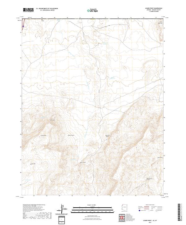
2021 Map of Lizard Point
USGS Topo · Published 2021About this map
Lizard Point serves as a prominent overlook in this corner of the Mojave Desert, where the landscape is defined by the ephemeral drainage systems of the Arizona strip. This 2021 survey illustrates a territory shaped by water management in an arid environment, featuring scattered collection points such as North Tank, State Line Reservoir, and Mokaac Reservoir. The convergence of Mokaac Wash and Atkinville Wash underscores the natural irrigation patterns that have historically dictated movement through the high desert.
Find a feature on this map
24 named features on this map. Tap any name to fly to it.
Don’t see what you’re looking for? This feature index may not catch every label — zoom into the map to look around manually.
Map Details
Editions of this 2021 Lizard Point Map
This is the sole edition of this map. No revisions or reprints were ever made.
Other maps of this area

1885 · St. George
USGS Topo · 1:250,000

1886 · Mt. Trumbull
USGS Topo · 1:250,000

1891 · St. George
USGS Topo · 1:250,000

1892 · Mt. Trumbull
USGS Topo · 1:250,000

1953 · Cedar City
USGS Topo · 1:250,000

1953 · Grand Canyon
USGS Topo · 1:250,000

1954 · Hurricane Cliffs 2 NW
USGS Topo · 1:24,000

1954 · Wolf Hole Mtn. NW
USGS Topo · 1:24,000

1954 · La Verkin 3 SW
USGS Topo · 1:24,000

1954 · Wolf Hole Mtn. NE
USGS Topo · 1:24,000