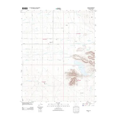
2013 Map of Lobatos
USGS Topo · Published 2013About this map
La Isla and its surrounding landscape reflect the enduring agricultural traditions of southern Colorado's San Luis Valley. This region is characterized by a sophisticated network of gravity-fed irrigation systems that define the rural economy and land use patterns. By 2013, the landscape shows a dense grid of historic water infrastructure, essential for maintaining the ranching and farming operations that have sustained local families for generations. The topography is largely defined by the gradual slopes and open terrain typical of the high-altitude basin, where water rights and access to the river systems are central to the community's history and settlement structure.
Find a feature on this map
1 named feature on this map. Tap any name to fly to it.
Don’t see what you’re looking for? This feature index may not catch every label — zoom into the map to look around manually.
Map Details
Editions of this 2013 Lobatos Map
This is the sole edition of this map. No revisions or reprints were ever made.
Other maps of this area

1918 · Tusas
USGS Topo · 1:125,000

1922 · Conejos
USGS Topo · 1:125,000

1945 · Durango
USGS Topo · 1:250,000

1953 · Durango
USGS Topo · 1:250,000

1954 · Durango
USGS Topo · 1:250,000

1954 · Raton
USGS Topo · 1:250,000

1954 · Trinidad
USGS Topo · 1:250,000

1954 · Aztec
USGS Topo · 1:250,000

1955 · Trinidad
USGS Topo · 1:250,000

1958 · Raton
USGS Topo · 1:250,000