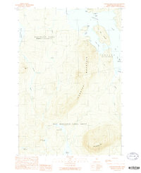
1989 Map of Lobster Mountain
USGS Topo · Published 1989About this map
Lobster Mountain dominates the central landscape of this North Woods survey, surrounded by the intricate waterways of Lobster Lake and several smaller glacial ponds. The map details the complex shoreline of the lake, including the distinctive Little Claw and Big Claw inlets, alongside Big Island and Marion Island. This area is defined by its historic land divisions, notably the East Middlesex Canal Grant and the township of Northeast Carry.
Find a feature on this map
26 named features on this map. Tap any name to fly to it.
Don’t see what you’re looking for? This feature index may not catch every label — zoom into the map to look around manually.
Map Details
Editions of this 1989 Lobster Mountain Map
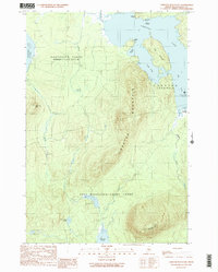
2 editions found
Other maps of this area

1920 · Moosehead Lake
USGS Topo · 1:62,500

1922 · Moosehead Lake
USGS Topo · 1:62,500

1930 · Moosehead Lake
USGS Topo · 1:62,500

1944 · Moosehead Lake
USGS Topo · 1:62,500

1952 · First Roach Pond
USGS Topo · 1:62,500

1954 · North East Carry
USGS Topo · 1:62,500

1954 · Grant Farm
USGS Topo · 1:62,500

1954 · Millinocket
USGS Topo · 1:250,000

1957 · Moosehead Lake
USGS Topo · 1:62,500

1958 · Millinocket
USGS Topo · 1:250,000
Featured Places
- Northeast Carry Township, ME
- East Middlesex Canal Grant Township, ME
- Lobster Township, ME
- TX R14 WELS, ME
- Piscataquis County, ME