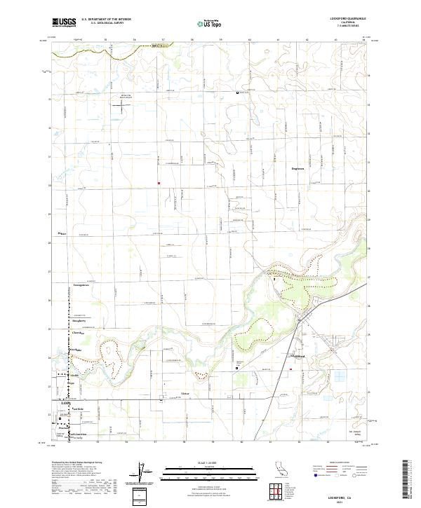
2021 Map of Lockeford
USGS Topo · Published 2021About this map
The Mokelumne River winds through the heart of the San Joaquin Valley, defining the agricultural and residential layout of this fertile region. Near its banks, the settlement of Lockeford serves as a local hub, surrounded by smaller communities such as Victor, Peltier, and Youngstown. The landscape is etched with a grid of rural roads like Liberty Rd and Acampo Rd, connecting numerous family-named landmarks and historical sites. Genealogy interests are well-served by the presence of several burial grounds, including Harmony Grove Cem, Locke Cem, and the Lodi Memorial Park and Cem near the edge of Lodi. Aviation history is represented by the Vetters Sky Ranch Airport located in the northern reaches of the quadrangle. Water features like Jahant Slough and Dry Cr further illustrate the drainage patterns of this intensive farming district.
Find a feature on this map
57 named features on this map. Tap any name to fly to it.
Don’t see what you’re looking for? This feature index may not catch every label — zoom into the map to look around manually.
Map Details
Editions of this 2021 Lockeford Map
This is the sole edition of this map. No revisions or reprints were ever made.
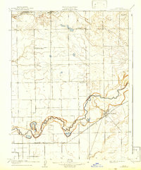
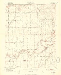
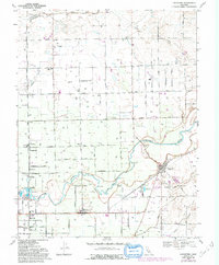
Historical Maps of Victor Through Time
4 maps found