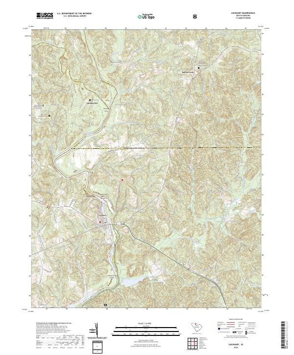
2024 Map of Lockhart
USGS Topo · Published 2024About this map
The Broad River serves as the central artery of this region, winding through the borders of Union, Cherokee, York, and Chester counties. Along its banks, the map documents a legacy of river crossings and rapids, including Pinckney Ferry and the Thompson Ferry, which once provided vital connections between these rural communities. The river's natural power is evident at Lockharts Upper Shoals and Lockhart Lower Shoals, features that historically influenced the industrial development of the town of Lockhart.
Find a feature on this map
82 named features on this map. Tap any name to fly to it.
Don’t see what you’re looking for? This feature index may not catch every label — zoom into the map to look around manually.
Map Details
Editions of this 2024 Lockhart Map
This is the sole edition of this map. No revisions or reprints were ever made.
Other maps of this area

1907 · Sharon
USGS Topo · 1:62,500

1941 · Spartanburg
USGS Topo · 1:250,000

1953 · Spartanburg
USGS Topo · 1:250,000

1960 · Spartanburg
USGS Topo · 1:250,000

1963 · Spartanburg
USGS Topo · 1:250,000

1964 · Spartanburg
USGS Topo · 1:250,000
1968 · Wilkinsville
USGS Topo · 1:24,000

1969 · Kelton
USGS Topo · 1:24,000

1969 · Baton Rouge
USGS Topo · 1:24,000
1969 · Leeds
USGS Topo · 1:24,000