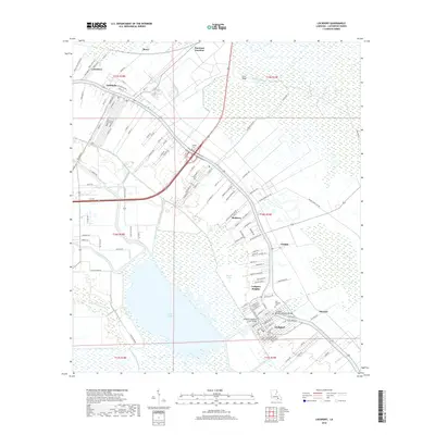
2018 Map of Lockport
USGS Topo · Published 2018About this map
Bayou Lafourche dictates the settlement pattern of this part of Lafourche Parish, with towns and homesteads hugging its banks while the surrounding terrain transitions into the wetlands of Lake Fields. The map documents the dense residential development in Lockport and Lockport Heights, where engineered crossings like the Lockport Bayou Lafourche Bridge and Lockport Company Canal Bridge connect the community across vital waterways. Further north, the landscape is shaped by the intersection of rail and road at Raceland Junction and Bowie, reflecting the area's agricultural and industrial transit history. Local heritage is preserved in sites such as Hadley Cem near Mathews and New Fountain Cem in Lockport, while the surrounding marshlands are articulated by features like Bayou Grand-Coteau and Bayou Jollet, illustrating the delicate balance between dry land and the Louisiana delta.
Find a feature on this map
126 named features on this map. Tap any name to fly to it.
Don’t see what you’re looking for? This feature index may not catch every label — zoom into the map to look around manually.
Map Details
Editions of this 2018 Lockport Map
This is the sole edition of this map. No revisions or reprints were ever made.
Other maps of this area

1891 · Hahnville
USGS Topo · 1:62,500

1892 · Lac Des Allemands
USGS Topo · 1:62,500

1892 · Cut-Off
USGS Topo · 1:62,500

1892 · Houma
USGS Topo · 1:62,500

1932 · Houma SE
USGS Topo · 1:31,680

1932 · Lac Des Allemands SE
USGS Topo · 1:31,680

1932 · Lac Des Allemands SW
USGS Topo · 1:31,680

1932 · Houma SW
USGS Topo · 1:31,680

1932 · Houma NE
USGS Topo · 1:31,680

1932 · Houma NW
USGS Topo · 1:31,680