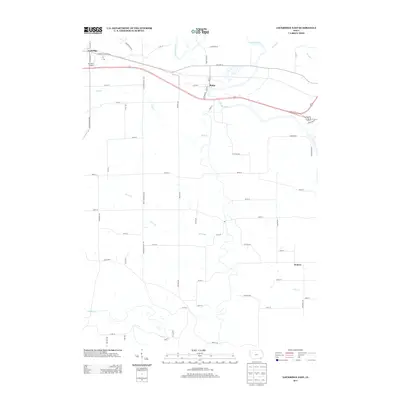
2013 Map of Lockridge East
USGS Topo · Published 2013About this map
Lockridge and Rome anchor the northern landscape of this Jefferson County survey, where the Skunk River winds through a network of rural roads and timbered drainages. The area is defined by its water systems, from the prominent Wolf Cr and Honey Cr in the north to Cedar Cr and Fish Cr in the south. These waterways dictate the local geography, with roads like Jefferson Henry Ave and Benton Ave following the section lines across the agricultural plateaus between the creek valleys. A small landing strip, R S Auto Airport, sits just south of Lockridge, while the small settlement of Denova marks a quiet junction in the southeastern portion of the map. The persistence of local family names is evident in thoroughfares such as Ensminger Ln and White Oak Rd, reflecting the deep-rooted rural character of this eastern Iowa township.
Find a feature on this map
59 named features on this map. Tap any name to fly to it.
Don’t see what you’re looking for? This feature index may not catch every label — zoom into the map to look around manually.
Map Details
Editions of this 2013 Lockridge East Map
This is the sole edition of this map. No revisions or reprints were ever made.
Other maps of this area

1958 · Burlington
USGS Topo · 1:250,000

1958 · Davenport
USGS Topo · 1:250,000

1961 · Burlington
USGS Topo · 1:250,000

1961 · Davenport
USGS Topo · 1:250,000

1962 · Davenport
USGS Topo · 1:250,000

1963 · Burlington
USGS Topo · 1:250,000

1980 · Lockridge West
USGS Topo · 1:24,000

1980 · Trenton
USGS Topo · 1:24,000
1980 · Salina
USGS Topo · 1:24,000

1980 · Lockridge East
USGS Topo · 1:24,000