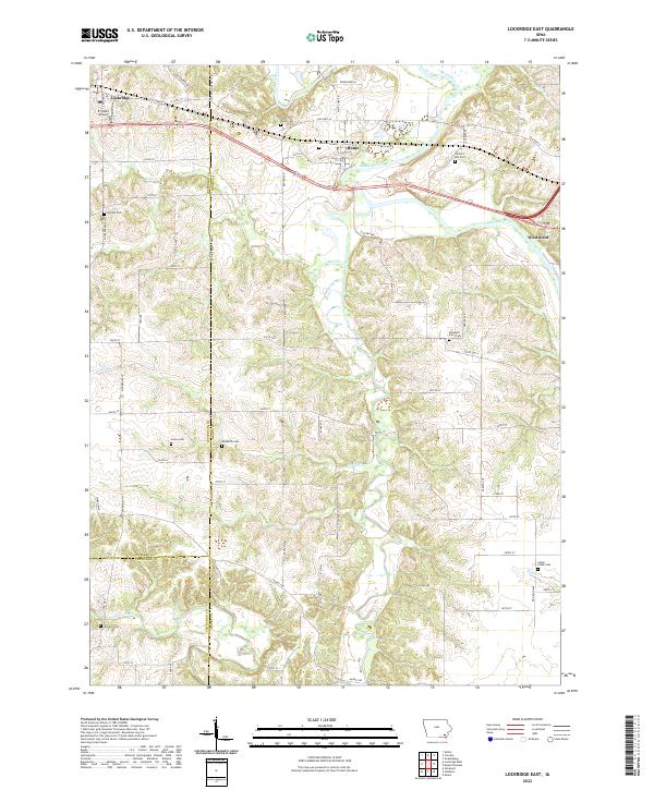
2022 Map of Lockridge East
USGS Topo · Published 2022About this map
The Skunk River winds through this landscape, which straddles the borders of Jefferson, Henry, and Van Buren counties. The small communities of Lockridge, Rome, and Westwood are connected by a network of rural roads and the corridor of Old Hwy 34. The area is characterized by a series of tributary creeks including Wolf Cr, Berry Br, and Cedar Creek, which have carved significant valleys into the Iowa terrain.
Find a feature on this map
70 named features on this map. Tap any name to fly to it.
Don’t see what you’re looking for? This feature index may not catch every label — zoom into the map to look around manually.
Map Details
Editions of this 2022 Lockridge East Map
This is the sole edition of this map. No revisions or reprints were ever made.
Other maps of this area

1958 · Burlington
USGS Topo · 1:250,000

1958 · Davenport
USGS Topo · 1:250,000

1961 · Burlington
USGS Topo · 1:250,000

1961 · Davenport
USGS Topo · 1:250,000

1962 · Davenport
USGS Topo · 1:250,000

1963 · Burlington
USGS Topo · 1:250,000

1980 · Lockridge West
USGS Topo · 1:24,000

1980 · Trenton
USGS Topo · 1:24,000
1980 · Salina
USGS Topo · 1:24,000

1980 · Lockridge East
USGS Topo · 1:24,000