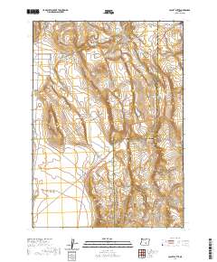
2020 Map of Locust Butte
USGS Topo · Published 2020About this map
Wagontire serves as the primary focal point in this high-desert region of Harney and Lake counties, situated along the Dry Valley Hwy and supported by the Wagontire Airport. This area is defined by its critical water management infrastructure, where livestock and wildlife depend on features such as Wolter Lake, Locust Butte Reservoir, and the Highway Lake Waterhole. The map illustrates a landscape of sparse but essential connectivity, with Butte Valley Rd and Wagontire Lo Rd traversing the terrain surrounding the prominent Locust Butte. The presence of Shroder Waterhole on the eastern edge further underscores the reliance on localized water sources in an otherwise arid expanse, marking the intersection of natural topography and ranching history.
Find a feature on this map
16 named features on this map. Tap any name to fly to it.
Don’t see what you’re looking for? This feature index may not catch every label — zoom into the map to look around manually.
Map Details
Editions of this 2020 Locust Butte Map
This is the sole edition of this map. No revisions or reprints were ever made.
Other maps of this area

1955 · Crescent
USGS Topo · 1:250,000

1955 · Burns
USGS Topo · 1:250,000

1957 · Crescent
USGS Topo · 1:250,000

1958 · Crescent
USGS Topo · 1:250,000

1958 · Burns
USGS Topo · 1:250,000

1959 · Burns
USGS Topo · 1:250,000

1970 · Crescent
USGS Topo · 1:250,000

1980 · Wagontire Mtn West
USGS Topo · 1:24,000

1980 · Wagontire Mtn East
USGS Topo · 1:24,000
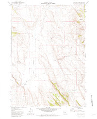
1981 · Rams Butte
USGS Topo · 1:24,000