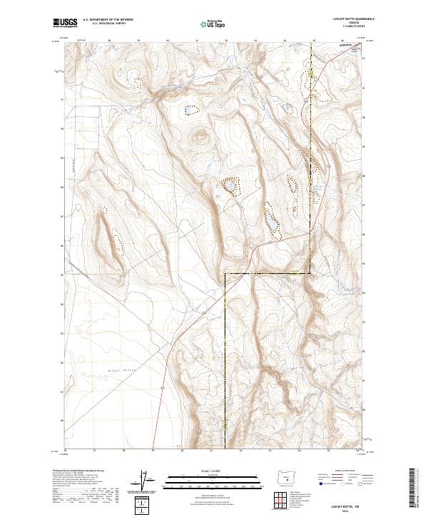
2024 Map of Locust Butte
USGS Topo · Published 2024About this map
Wagontire and its surrounding high desert landscape are defined by the critical management of water in a semi-arid environment. The presence of Locust Butte Reservoir, Wolter Lake, and livestock-supporting features like Highway Lake Waterhole and Shroder Waterhole illustrates the vital water infrastructure necessary for ranching and survival in this corner of the state. The terrain transitions into the broad expanse of Alkali Valley, a geographic marker of the region's ancient lake beds and saline basins.
Find a feature on this map
16 named features on this map. Tap any name to fly to it.
Don’t see what you’re looking for? This feature index may not catch every label — zoom into the map to look around manually.
Map Details
Editions of this 2024 Locust Butte Map
This is the sole edition of this map. No revisions or reprints were ever made.
Other maps of this area

1955 · Crescent
USGS Topo · 1:250,000

1955 · Burns
USGS Topo · 1:250,000

1957 · Crescent
USGS Topo · 1:250,000

1958 · Crescent
USGS Topo · 1:250,000

1958 · Burns
USGS Topo · 1:250,000

1959 · Burns
USGS Topo · 1:250,000

1970 · Crescent
USGS Topo · 1:250,000

1980 · Wagontire Mtn West
USGS Topo · 1:24,000

1980 · Wagontire Mtn East
USGS Topo · 1:24,000
1981 · Rams Butte
USGS Topo · 1:24,000