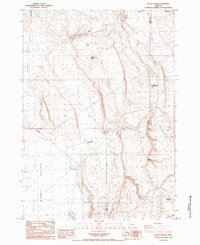
1984 Map of Locust Butte
USGS Topo · Published 1984About this map
Locust Butte rises above a high desert landscape defined by the intersection of Butte Valley and Alkali Valley. This 1984 provisional survey illustrates the sparse, working nature of the Lake and Harney county borderlands, where the infrastructure of cattle ranching and modern industry meet. Notable landmarks like Toms Bedground and family-named water sources such as Toms Waterhole and Wolter Lake suggest a long history of seasonal livestock movement. The presence of the Chem Nuclear facility and a major Transmission Line cutting across the flats highlights the region's mid-century transition toward industrial utility. Travel is oriented around the Wagontire Road, which navigates a terrain of Sand Dunes, Ryegrass flats, and the deep incision of Venator Canyon.
Find a feature on this map
19 named features on this map. Tap any name to fly to it.
Don’t see what you’re looking for? This feature index may not catch every label — zoom into the map to look around manually.
Map Details
Editions of this 1984 Locust Butte Map
This is the sole edition of this map. No revisions or reprints were ever made.
Other maps of this area

1955 · Crescent
USGS Topo · 1:250,000

1955 · Burns
USGS Topo · 1:250,000

1957 · Crescent
USGS Topo · 1:250,000

1958 · Crescent
USGS Topo · 1:250,000

1958 · Burns
USGS Topo · 1:250,000

1959 · Burns
USGS Topo · 1:250,000

1970 · Crescent
USGS Topo · 1:250,000

1980 · Wagontire Mtn West
USGS Topo · 1:24,000

1980 · Wagontire Mtn East
USGS Topo · 1:24,000
1981 · Rams Butte
USGS Topo · 1:24,000