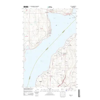
2014 Map of Lofall
USGS Topo · Published 2014About this map
Hood Canal serves as the central corridor of this coastal survey, dividing the land between Jefferson and Kitsap Counties. On the eastern shore, the Kitsap Peninsula is characterized by established communities like Lofall and Breidablick, where the Breidablick Chapel and its associated cemetery sit near the junction of NW Pioneer Way. Further south, the map details the northern reaches of Bangor Base and the settlement of Vinland, which is anchored by the Vinland Lutheran Church and Vinland Lutheran Church Cem.
Find a feature on this map
102 named features on this map. Tap any name to fly to it.
Don’t see what you’re looking for? This feature index may not catch every label — zoom into the map to look around manually.
Map Details
Editions of this 2014 Lofall Map
This is the sole edition of this map. No revisions or reprints were ever made.
Other maps of this area

1936 · Point Misery
USGS Topo · 1:62,500

1937 · Port Orchard
USGS Topo · 1:62,500

1937 · Port Gamble
USGS Topo · 1:62,500

1940 · Port Gamble
USGS Topo · 1:62,500

1940 · Point Misery
USGS Topo · 1:62,500

1940 · Quilcene
USGS Topo · 1:62,500

1953 · Seabeck
USGS Topo · 1:24,000

1953 · Poulsbo
USGS Topo · 1:24,000

1953 · Quilcene
USGS Topo · 1:24,000

1953 · Hansville
USGS Topo · 1:24,000