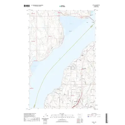
2020 Map of Lofall
USGS Topo · Published 2020About this map
Hood Canal dominates this coastal landscape, bisecting the Great Peninsula and separating Kitsap and Jefferson counties. The northern terminus of the Poulsbo city limits anchors the southern edge of the sheet, while the northern shoreline is defined by the Hood Canal Bridge and Termination Point. The western shore, characterized by numerous small bodies of water like Lost Lake and Thorndyke Lake, remains sparsely populated with winding timber roads.
Find a feature on this map
116 named features on this map. Tap any name to fly to it.
Don’t see what you’re looking for? This feature index may not catch every label — zoom into the map to look around manually.
Map Details
Editions of this 2020 Lofall Map
This is the sole edition of this map. No revisions or reprints were ever made.
Other maps of this area

1936 · Point Misery
USGS Topo · 1:62,500

1937 · Port Orchard
USGS Topo · 1:62,500

1937 · Port Gamble
USGS Topo · 1:62,500

1940 · Port Gamble
USGS Topo · 1:62,500

1940 · Point Misery
USGS Topo · 1:62,500

1940 · Quilcene
USGS Topo · 1:62,500

1953 · Seabeck
USGS Topo · 1:24,000

1953 · Poulsbo
USGS Topo · 1:24,000

1953 · Quilcene
USGS Topo · 1:24,000

1953 · Hansville
USGS Topo · 1:24,000