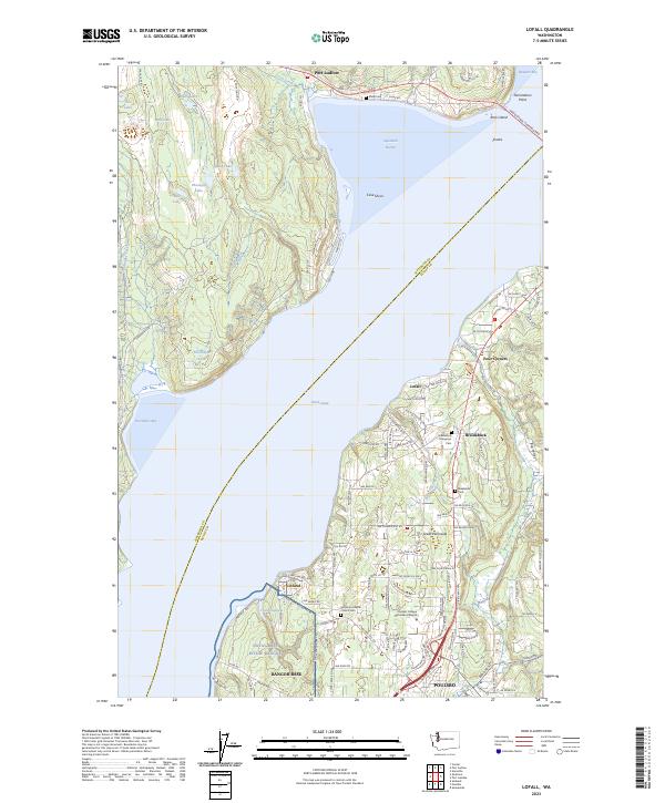
2023 Map of Lofall
USGS Topo · Published 2023About this map
Naval Base Kitsap Bangor occupies a significant portion of the western shoreline on the Great Peninsula, bordering the deep waters of the Hood Canal. This 2023 edition reflects a landscape where military installations and residential communities like Lofall, Vinland, and Poulsbo coexist alongside substantial natural features. The Hood Canal Floating Brg provides a vital transportation link across the water at Termination Point, connecting Kitsap and Jefferson counties.
Find a feature on this map
120 named features on this map. Tap any name to fly to it.
Don’t see what you’re looking for? This feature index may not catch every label — zoom into the map to look around manually.
Map Details
Editions of this 2023 Lofall Map
This is the sole edition of this map. No revisions or reprints were ever made.
Other maps of this area

1936 · Point Misery
USGS Topo · 1:62,500

1937 · Port Orchard
USGS Topo · 1:62,500

1937 · Port Gamble
USGS Topo · 1:62,500

1940 · Port Gamble
USGS Topo · 1:62,500

1940 · Point Misery
USGS Topo · 1:62,500

1940 · Quilcene
USGS Topo · 1:62,500

1953 · Seabeck
USGS Topo · 1:24,000

1953 · Poulsbo
USGS Topo · 1:24,000

1953 · Quilcene
USGS Topo · 1:24,000

1953 · Hansville
USGS Topo · 1:24,000