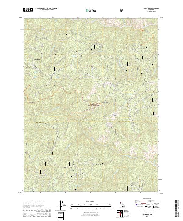
2021 Map of Log Spring
USGS Topo · Published 2021About this map
The high ridges and glades of the Mendocino National Forest define this 2021 survey of the border between Tehama and Glenn Counties. The terrain is structured by a series of prominent elevations, including the whimsical Hokey Pokey Ridge and the extensive Log Spring Ridge. Human movement through this landscape is recorded in a network of trails and backcountry roads such as the Paskenta-Mendocino Pass and the Lantz Ridge Trl. Small clearings and seasonal water sources are scattered throughout the forest, with named points like Mose Genot Glade and Dead Mule Spring providing critical landmarks for navigation. While mostly primitive, the area includes the Sunnyside settlement, standing as a lone outpost amidst the drainage systems of Thomes Cr and Grindstone Cr. The map captures a modern view of this managed wilderness, noting the intersection of traditional topographic features with current forest service infrastructure.
Find a feature on this map
44 named features on this map. Tap any name to fly to it.
Don’t see what you’re looking for? This feature index may not catch every label — zoom into the map to look around manually.
Map Details
Editions of this 2021 Log Spring Map
This is the sole edition of this map. No revisions or reprints were ever made.
Other maps of this area

1919 · Elk Creek
USGS Topo · 1:62,500

1948 · Elk Creek
USGS Topo · 1:62,500

1952 · Paskenta
USGS Topo · 1:62,500

1952 · Hull Mountain
USGS Topo · 1:62,500

1952 · Anthony Peak
USGS Topo · 1:62,500

1957 · Elk Creek
USGS Topo · 1:62,500

1957 · Ukiah
USGS Topo · 1:250,000

1960 · Ukiah
USGS Topo · 1:250,000

1967 · Plaskett Ridge
USGS Topo · 1:24,000
1967 · Plaskett meadows
USGS Topo · 1:24,000