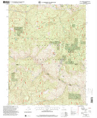
1995 Map of Log Spring
USGS Topo · Published 2001About this map
Mendocino National Forest defines the rugged character of this high-elevation landscape, where a network of ridgelines and seasonal springs dictated the locations of early backcountry outposts. The map reveals a cluster of primitive sites and shelters, including Side Rod Camp, Saturday Camp, and Blackjack Camp, interspersed with family-named landmarks like Bodkin Cabin and Powell Cabin. These locations, often situated near vital water sources such as Buttermilk Spring and Beverly Spring, reflect the area's history of forest management and seasonal grazing. The terrain is dramatically partitioned by a series of prominent ridges, most notably Log Spring Ridge, Grindstone Ridge, and the whimsically named Hokey Pokey Ridge. This 1995 revision of earlier 1960s topography highlights how 4WD trails and forest service routes became the primary veins for movement across the Tehama and Glenn County line, connecting remote glades like Euchre Glade and Poison Glade to the larger drainage systems of Thomes Creek and Grindstone Creek.
Find a feature on this map
35 named features on this map. Tap any name to fly to it.
Don’t see what you’re looking for? This feature index may not catch every label — zoom into the map to look around manually.
Map Details
Editions of this 1995 Log Spring Map
This is the sole edition of this map. No revisions or reprints were ever made.
Other maps of this area

1919 · Elk Creek
USGS Topo · 1:62,500

1948 · Elk Creek
USGS Topo · 1:62,500

1952 · Paskenta
USGS Topo · 1:62,500

1952 · Hull Mountain
USGS Topo · 1:62,500

1952 · Anthony Peak
USGS Topo · 1:62,500

1957 · Elk Creek
USGS Topo · 1:62,500

1957 · Ukiah
USGS Topo · 1:250,000

1960 · Ukiah
USGS Topo · 1:250,000

1967 · Plaskett Ridge
USGS Topo · 1:24,000
1967 · Plaskett meadows
USGS Topo · 1:24,000