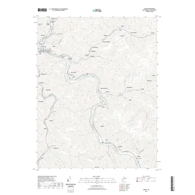
2019 Map of Logan
USGS Topo · Published 2019About this map
The Guyandotte River winds through a landscape of deep valleys and narrow ridges, serving as the central corridor for the city of Logan and several coal-country settlements. This 2019 survey illustrates the dense development along the river flats and the various bridges that knit these communities together, including the Midelburg Bridge and the Dingess Street Bridge. The mapping of the surrounding hillsides reveals a pattern of scattered homesteads and family burial grounds such as Old City Cem and George F Browning Cem.
Find a feature on this map
120 named features on this map. Tap any name to fly to it.
Don’t see what you’re looking for? This feature index may not catch every label — zoom into the map to look around manually.
Map Details
Editions of this 2019 Logan Map
This is the sole edition of this map. No revisions or reprints were ever made.
Other maps of this area

1887 · Warfield
USGS Topo · 1:125,000

1891 · Oceana
USGS Topo · 1:125,000

1891 · Warfield
USGS Topo · 1:125,000

1893 · Oceana
USGS Topo · 1:125,000

1898 · Oceana
USGS Topo · 1:125,000

1909 · Matewan
USGS Topo · 1:48,000

1909 · Gilbert
USGS Topo · 1:48,000

1910 · Holden
USGS Topo · 1:48,000

1912 · Gilbert
USGS Topo · 1:62,500

1912 · Holden
USGS Topo · 1:62,500