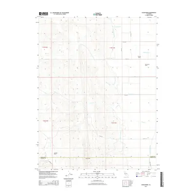
2015 Map of Logan Ridge
USGS Topo · Published 2015About this map
Logan Ridge serves as the dominant north-south spine on this map, separating the western foothills of Antelope Valley from the flat expanse of the Sacramento Valley and Central Valley to the east. The landscape is a study in California's hydraulic engineering, where the Tehama-Colusa Canal and Glenn-Colusa Canal cut definitive lines through the terrain to manage water across the arid stretches of the valley floor. The boundary between Glenn Co and Colusa Co bisects the southern half of the sheet, providing a specific reference for local historians and land surveyors. Natural drainages like N Fork Logan Cr, Baker Slough, and Hunters Cr reveal the seasonal water patterns of the region, while a network of rural roads such as Co Road B and Co Road 69 establishes the grid of agricultural transport at the time of this 2015 survey.
Find a feature on this map
26 named features on this map. Tap any name to fly to it.
Don’t see what you’re looking for? This feature index may not catch every label — zoom into the map to look around manually.
Map Details
Editions of this 2015 Logan Ridge Map
This is the sole edition of this map. No revisions or reprints were ever made.
Other maps of this area

1904 · Logan Creek
USGS Topo · 1:24,000

1904 · Sites
USGS Topo · 1:24,000

1906 · Maxwell
USGS Topo · 1:62,500

1906 · Willows
USGS Topo · 1:62,500

1917 · Kurand
USGS Topo · 1:31,680

1917 · Lyman
USGS Topo · 1:31,680

1917 · Logandale
USGS Topo · 1:31,680

1917 · Sites
USGS Topo · 1:31,680

1917 · Delevan
USGS Topo · 1:31,680

1918 · Logan Creek
USGS Topo · 1:31,680