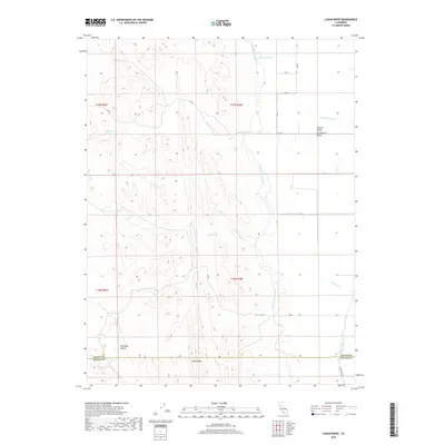
2018 Map of Logan Ridge
USGS Topo · Published 2018About this map
Logan Ridge serves as the central geological spine of this landscape, separating the more complex western terrain from the expansive flats of the Central Valley Sacramento Valley. The artificial geometry of the Tehama-Colusa Canal cuts a distinct line through the eastern sections, providing a stark contrast to the meandering natural drainages like Hunters Creek and North Fork Logan Creek. In the south, the map illustrates the boundary between Glenn and Colusa counties as it crosses Antelope Valley. The rural character is defined by a grid of local infrastructure, including Road 65 and Noel Evan Road, which link the various drainages and agricultural sections. This survey documents the intersection of natural watercourses, such as Baker Slough and Funks Creek, with the modern irrigation systems that support the regional economy.
Find a feature on this map
27 named features on this map. Tap any name to fly to it.
Don’t see what you’re looking for? This feature index may not catch every label — zoom into the map to look around manually.
Map Details
Editions of this 2018 Logan Ridge Map
This is the sole edition of this map. No revisions or reprints were ever made.
Other maps of this area

1904 · Logan Creek
USGS Topo · 1:24,000

1904 · Sites
USGS Topo · 1:24,000

1906 · Maxwell
USGS Topo · 1:62,500

1906 · Willows
USGS Topo · 1:62,500

1917 · Kurand
USGS Topo · 1:31,680

1917 · Lyman
USGS Topo · 1:31,680

1917 · Logandale
USGS Topo · 1:31,680

1917 · Sites
USGS Topo · 1:31,680

1917 · Delevan
USGS Topo · 1:31,680

1918 · Logan Creek
USGS Topo · 1:31,680