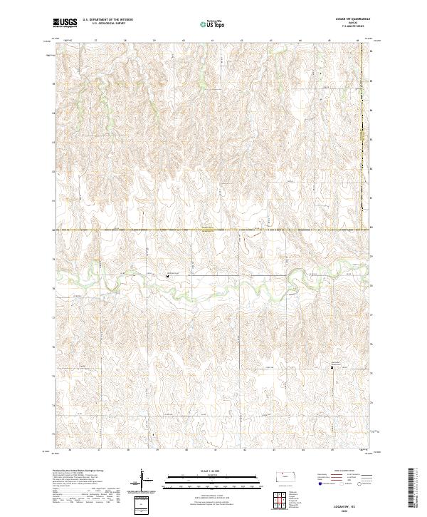
2022 Map of Logan SW
USGS Topo · Published 2022About this map
Whitfield Cem sits along DD RD in this section of the High Plains where the border of Norton Co and Graham Co divides the landscape. The terrain is defined by the winding course of Bow Cr, which flows eastward through a series of deeply dissected draws and ridges. This 2022 survey captures a rural landscape dominated by a strict section-line road grid, including 330 Th Ave and 340 Th Ave, which provide access to remote agricultural tracts and historic family sites. To the southeast, the Buchanan Brown Cem remains a quiet landmark of early settlement near the Norton and Phillips County line. The density of named county roads, such as Co RD 565 and Aa RD, highlights the enduring importance of this transportation network to the local farming community.
Find a feature on this map
33 named features on this map. Tap any name to fly to it.
Don’t see what you’re looking for? This feature index may not catch every label — zoom into the map to look around manually.
Map Details
Editions of this 2022 Logan SW Map
This is the sole edition of this map. No revisions or reprints were ever made.
Other maps of this area

1893 · Norton
USGS Topo · 1:125,000

1893 · Hill
USGS Topo · 1:125,000

1955 · Beloit
USGS Topo · 1:250,000

1959 · Beloit
USGS Topo · 1:250,000

1969 · Nicodemus
USGS Topo · 1:24,000

1978 · Logan
USGS Topo · 1:24,000

1978 · Edmond
USGS Topo · 1:24,000
1978 · Densmore
USGS Topo · 1:24,000

1978 · Edmond SE
USGS Topo · 1:24,000
1979 · Logan SW
USGS Topo · 1:24,000