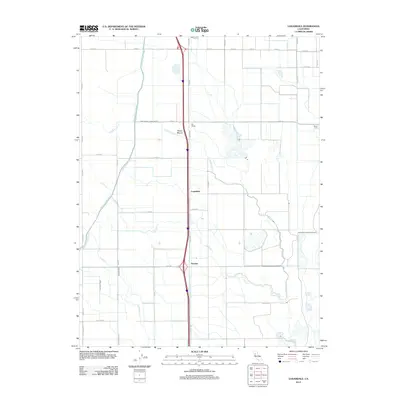
2012 Map of Logandale
USGS Topo · Published 2012About this map
Logandale and Norman anchor this landscape in Glenn County, where the agricultural geometry of Northern California is defined by an extensive network of irrigation and drainage. The Glenn-Colusa Canal and Provident-Western Canal cut through the terrain, supporting the large-scale farming operations indicated by sites like Minor Farm. This area demonstrates the complex water management required for the Sacramento Valley's productivity, with Logan Cr and the North Fork Logan Creek meandering through a grid of county roads. Industrial and transport history is represented by Riz Siding, located along the central transit corridor that follows the path of Old Hwy 99W. The subtle elevation of Pelican Mound provides one of the few natural landmarks in an otherwise meticulously engineered environment.
Find a feature on this map
32 named features on this map. Tap any name to fly to it.
Don’t see what you’re looking for? This feature index may not catch every label — zoom into the map to look around manually.
Map Details
Editions of this 2012 Logandale Map
This is the sole edition of this map. No revisions or reprints were ever made.
Other maps of this area

1904 · Logan Creek
USGS Topo · 1:24,000

1904 · Sites
USGS Topo · 1:24,000

1906 · Maxwell
USGS Topo · 1:62,500

1906 · Willows
USGS Topo · 1:62,500

1917 · Kurand
USGS Topo · 1:31,680

1917 · Lyman
USGS Topo · 1:31,680

1917 · Jacinto
USGS Topo · 1:31,680

1917 · Logandale
USGS Topo · 1:31,680

1917 · Compton Landing
USGS Topo · 1:31,680

1917 · Sites
USGS Topo · 1:31,680