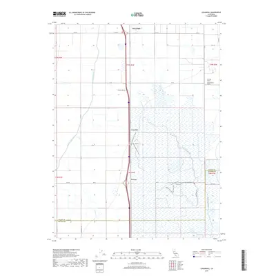
2018 Map of Logandale
USGS Topo · Published 2018About this map
The agricultural heart of the Sacramento Valley is defined here by a massive network of irrigation and conservation infrastructure along the border of Glenn and Colusa counties. Central to the landscape is the Glenn-Colusa Canal, which cuts across the terrain to support the region's intensive farming. The small settlements of Logandale and Norman are situated along the transit corridor of Old Hwy 99W, reflecting the historical development of the Central Valley as a transportation and produce hub. East of these settlements, the map reveals a shift toward conservation and recreation, with extensive wetlands managed through the Wetlands Walking Trail (North) and its southern counterpart. These trails, alongside the Logan Creek Trail, navigate a complex hydrological system of creeks and canals, including the Provident Western Canal and N Fork Logan Cr, illustrating the delicate balance of water management in northern California.
Find a feature on this map
69 named features on this map. Tap any name to fly to it.
Don’t see what you’re looking for? This feature index may not catch every label — zoom into the map to look around manually.
Map Details
Editions of this 2018 Logandale Map
This is the sole edition of this map. No revisions or reprints were ever made.
Other maps of this area

1904 · Logan Creek
USGS Topo · 1:24,000

1904 · Sites
USGS Topo · 1:24,000

1906 · Maxwell
USGS Topo · 1:62,500

1906 · Willows
USGS Topo · 1:62,500

1917 · Kurand
USGS Topo · 1:31,680

1917 · Lyman
USGS Topo · 1:31,680

1917 · Jacinto
USGS Topo · 1:31,680

1917 · Logandale
USGS Topo · 1:31,680

1917 · Compton Landing
USGS Topo · 1:31,680

1917 · Sites
USGS Topo · 1:31,680