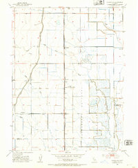
1952 Map of Logandale
USGS Topo · Published 1953About this map
Logandale sits at the heart of an intricate water management landscape in the early 1950s, defined by the heavy infrastructure of the Glenn-Colusa Canal and the Western Canal. The Central Valley terrain is dominated by the Sacramento National Wildlife Refuge Boundary, where duck ponds and marshy areas contrast with the surrounding agricultural grid. The presence of the Refuge Headquarters and a Lookout Tower signifies the active conservation efforts of the period.
Find a feature on this map
17 named features on this map. Tap any name to fly to it.
Don’t see what you’re looking for? This feature index may not catch every label — zoom into the map to look around manually.
Map Details
Editions of this 1952 Logandale Map
2 editions found
Other maps of this area

1904 · Logan Creek
USGS Topo · 1:24,000

1904 · Sites
USGS Topo · 1:24,000

1906 · Maxwell
USGS Topo · 1:62,500

1906 · Willows
USGS Topo · 1:62,500

1917 · Kurand
USGS Topo · 1:31,680

1917 · Lyman
USGS Topo · 1:31,680

1917 · Jacinto
USGS Topo · 1:31,680

1917 · Logandale
USGS Topo · 1:31,680

1917 · Compton Landing
USGS Topo · 1:31,680

1917 · Sites
USGS Topo · 1:31,680