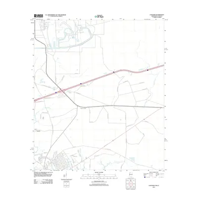
2012 Map of Logtown
USGS Topo · Published 2012About this map
Logtown sits within a complex network of coastal waterways and historical timber-era transit lines in Hancock County. The map documents a landscape defined by tidewater streams like Bogue Homa, Mulatto Bayou, and Bayou Lacroix. A distinctive local history is preserved in the placement of Logtown Cem and The Point Cem, providing essential points of reference for genealogists. The road network reveals the area's development through descriptive naming conventions, including Old Gainesville-Pearlington Rd, Old Napolean-Westonia Rd, and the Westonia Lookout. Traces of the region's logging and transport history are visible in the paths of the Hover Dummyline Rd and Chris Dummyline Rd, which once served as narrow-gauge rail routes for the timber industry.
Find a feature on this map
71 named features on this map. Tap any name to fly to it.
Don’t see what you’re looking for? This feature index may not catch every label — zoom into the map to look around manually.
Map Details
Editions of this 2012 Logtown Map
This is the sole edition of this map. No revisions or reprints were ever made.
Other maps of this area

1893 · Rigolets
USGS Topo · 1:62,500

1893 · Toulme
USGS Topo · 1:62,500

1914 · Nicholson
USGS Topo · 1:62,500

1921 · Nicholson
USGS Topo · 1:62,500

1935 · English Lookout
USGS Topo · 1:31,680

1935 · Grand Island Pass
USGS Topo · 1:31,680

1936 · Rigolets
USGS Topo · 1:62,500

1941 · Honey Island
USGS Topo · 1:31,680
1946 · Rigolets
USGS Topo · 1:31,680

1949 · Grand Island Pass
USGS Topo · 1:31,680