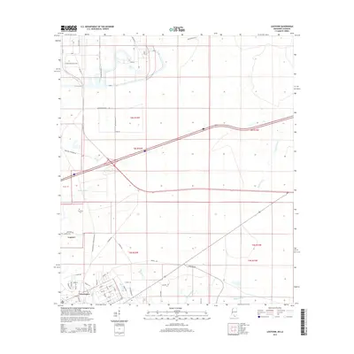
2015 Map of Logtown
USGS Topo · Published 2015About this map
Logtown and Pearlington sit at the edge of the Mississippi-Louisiana border, defined by the winding course of the Pearl River and its complex network of interconnected waterways. This 2015 survey details a landscape where residential development in Pearlington, characterized by streets like Birch Dr and Cedar St, contrasts with the more open, wetland-dominated terrain of the surrounding bayous. The map records the local geography of Mulatto Bayou, Bogue Homa, and Bayou Lacroix, which dictate the drainage and transportation patterns of southern Hancock County.
Find a feature on this map
64 named features on this map. Tap any name to fly to it.
Don’t see what you’re looking for? This feature index may not catch every label — zoom into the map to look around manually.
Map Details
Editions of this 2015 Logtown Map
This is the sole edition of this map. No revisions or reprints were ever made.
Other maps of this area

1893 · Rigolets
USGS Topo · 1:62,500

1893 · Toulme
USGS Topo · 1:62,500

1914 · Nicholson
USGS Topo · 1:62,500

1921 · Nicholson
USGS Topo · 1:62,500

1935 · English Lookout
USGS Topo · 1:31,680

1935 · Grand Island Pass
USGS Topo · 1:31,680

1936 · Rigolets
USGS Topo · 1:62,500

1941 · Honey Island
USGS Topo · 1:31,680
1946 · Rigolets
USGS Topo · 1:31,680

1949 · Grand Island Pass
USGS Topo · 1:31,680