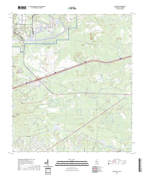
2024 Map of Logtown
USGS Topo · Published 2024About this map
Pearlington and the remnants of Logtown anchor this coastal landscape along the Pearl River delta. The area is defined by an intricate network of waterways, including Bogue Homa, Cowan Bayou, and Mulatto Bayou, which meander through the expanse of Devils Swamp. This terrain reflects the deep integration of scientific infrastructure and traditional settlements, with the massive footprint of the Naval Research Laboratory Stennis Space Center occupying the northern reaches. For genealogists, the map preserves the location of Logtown Cem and Point Cem, alongside a street-level grid in Pearlington featuring family-named routes like Hover Rd and Whipple Rd. The transition from marshland to managed government space is evident through specialized thoroughfares such as Shuttle Pkwy and S Canal Rd.
Find a feature on this map
77 named features on this map. Tap any name to fly to it.
Don’t see what you’re looking for? This feature index may not catch every label — zoom into the map to look around manually.
Map Details
Editions of this 2024 Logtown Map
This is the sole edition of this map. No revisions or reprints were ever made.
Other maps of this area

1893 · Rigolets
USGS Topo · 1:62,500

1893 · Toulme
USGS Topo · 1:62,500

1914 · Nicholson
USGS Topo · 1:62,500

1921 · Nicholson
USGS Topo · 1:62,500

1935 · English Lookout
USGS Topo · 1:31,680

1935 · Grand Island Pass
USGS Topo · 1:31,680

1936 · Rigolets
USGS Topo · 1:62,500

1941 · Honey Island
USGS Topo · 1:31,680
1946 · Rigolets
USGS Topo · 1:31,680

1949 · Grand Island Pass
USGS Topo · 1:31,680