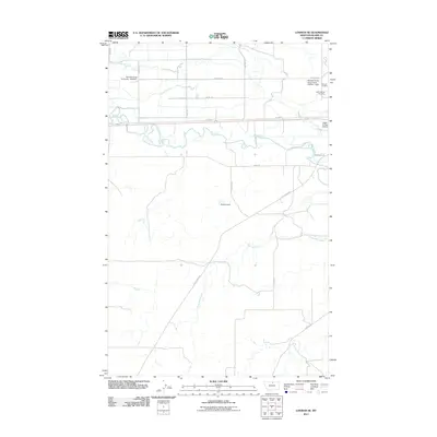
2011 Map of Lohman SE
USGS Topo · Published 2011About this map
The Milk River meanders through this portion of Blaine County, defining a landscape shaped by agricultural ranching and essential water management. North of the river, the corridor along Old Hwy 2 and Stephers Rd serves as a focal point for the local community, housing the Saint Gabriel Cemetery and Chinook Cemetery. The presence of the Maddox Ranch Corporation Number 1 Dam and Epstlon Dam on Three Mile Creek underscores the vital role of irrigation and water storage in this northern Montana prairie. Aviation and education also leave their mark on the terrain, represented by the Edgar G Obie Airport and facilities associated with Montana State University - Northern. This geography is further articulated by a network of rural routes, including Coal Mine Rd and Clear Creek Rd, which provide access to the expansive ranch lands south of the river valley.
Find a feature on this map
21 named features on this map. Tap any name to fly to it.
Don’t see what you’re looking for? This feature index may not catch every label — zoom into the map to look around manually.
Map Details
Editions of this 2011 Lohman SE Map
This is the sole edition of this map. No revisions or reprints were ever made.
Other maps of this area

1904 · Yantic
USGS Topo · 1:62,500

1904 · Chinook
USGS Topo · 1:62,500

1912 · Zurich
USGS Topo · 1:125,000

1953 · Havre
USGS Topo · 1:250,000

1956 · Lloyd
USGS Topo · 1:62,500

1956 · Cleveland
USGS Topo · 1:62,500

1957 · Havre
USGS Topo · 1:250,000

1958 · Havre
USGS Topo · 1:250,000

1964 · Rabbit Hills
USGS Topo · 1:24,000

1964 · Telescope Coulee
USGS Topo · 1:24,000