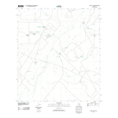
2010 Map of Loma Alta NW
USGS Topo · Published 2010About this map
Miles Ranch and San Jose Ranch anchor this ranching landscape in McMullen County, where the hydrology is defined by the wandering path of the Nueces River. The map reveals a complex network of drainage features, including the Old Nueces River Channel and several "slues," such as Winn Lake Slue and Outside Slue. This area is heavily modified for water management, evidenced by numerous named stock tanks like Joe Tank and Douglas Tank, as well as a series of reservoirs along the western edge including Bob Hinces Lake Number 1 and its accompanying dam. The presence of Chimney Ranch and House Tank near FM 624 suggests a territory where traditional land use and modern infrastructure meet, providing a clear record of South Texas water security and land division at the start of the 21st century.
Find a feature on this map
39 named features on this map. Tap any name to fly to it.
Don’t see what you’re looking for? This feature index may not catch every label — zoom into the map to look around manually.
Map Details
Editions of this 2010 Loma Alta NW Map
This is the sole edition of this map. No revisions or reprints were ever made.
Other maps of this area

1930 · Tilden
USGS Topo · 1:62,500

1937 · Loma Alta
USGS Topo · 1:62,500

1942 · Fowlerton
USGS Topo · 1:62,500

1942 · Tilden
USGS Topo · 1:62,500

1953 · Crystal City
USGS Topo · 1:250,000

1955 · Crystal City
USGS Topo · 1:250,000

1956 · Piedra Creek
USGS Topo · 1:62,500

1956 · Fowlerton
USGS Topo · 1:62,500

1961 · Crystal City
USGS Topo · 1:250,000

1968 · Crystal City
USGS Topo · 1:250,000