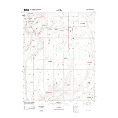
2013 Map of Loma Linda
USGS Topo · Published 2013About this map
The Animas River and Florida River define the irrigation-heavy landscape of La Plata County in this 2013 survey, which illustrates the transition from the city of Durango into the residential and agricultural expanses of Florida Mesa. Significant local infrastructure is prominent, including the Animas Air Park and the larger Durango-La Plata County Airport, alongside small-scale settlements like Loma Linda and Grandview. The map reveals a complex network of water management essential to the high desert climate, tracing features such as the Florida Canal, Florida Farmers Ditch, and Pastorius Reservoir. Deeply incised topography is evident in the many named draws and canyons like Wilson Gulch, Trumble Draw, and Phillips Canyon, while transportation corridors like Us-160 and Us-550 link these rural developments to the urban core. For genealogists and local historians, the inclusion of Crestview Memorial Garden and the proximity to the Carbon Junction area provide specific points of geographic reference.
Find a feature on this map
56 named features on this map. Tap any name to fly to it.
Don’t see what you’re looking for? This feature index may not catch every label — zoom into the map to look around manually.
Map Details
Editions of this 2013 Loma Linda Map
This is the sole edition of this map. No revisions or reprints were ever made.
Other maps of this area

1898 · Durango
USGS Topo · 1:62,500

1907 · Durango
USGS Topo · 1:62,500

1908 · Ignacio
USGS Topo · 1:125,000

1908 · Durango
USGS Topo · 1:62,500

1924 · Ignacio
USGS Topo · 1:125,000

1945 · Durango
USGS Topo · 1:250,000

1953 · Durango
USGS Topo · 1:250,000

1954 · Durango
USGS Topo · 1:250,000

1961 · Durango
USGS Topo · 1:250,000

1963 · Durango
USGS Topo · 1:250,000