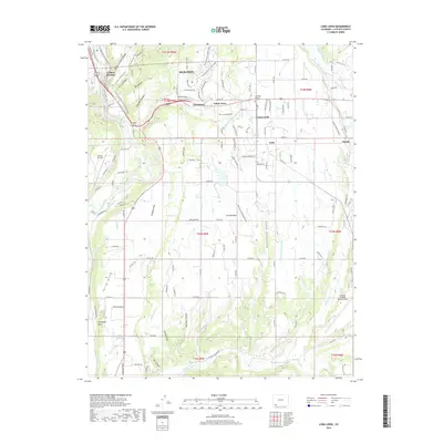
2019 Map of Loma Linda
USGS Topo · Published 2019About this map
Durango and its southeastern environs are defined by the convergence of the Animas River and the high agricultural plateaus of the San Juan Basin. This 2019 survey captures the modern interface of suburban expansion and historic irrigation infrastructure, where the Florida Farmers Ditch and Florida Canal serve the expansive Florida Mesa. The landscape transitions from the steep, carved terrain of Carbon Junction Canyon and Sale Barn Canyon in the west toward the residential clusters of Grandview and Piñon Acres. This era reflects a complex transport network, from the recreational Animas River Trail to the essential regional aviation hubs at Animas Air Park and the Durango-La Plata County Airport. Rural communities like Falfa and Sunnyside Mesa remain tied to the river systems, while the presence of the Crestview Memorial Garden and numerous named draws like Cottonwood Gulch provide specific points of interest for local history and genealogical research.
Find a feature on this map
141 named features on this map. Tap any name to fly to it.
Don’t see what you’re looking for? This feature index may not catch every label — zoom into the map to look around manually.
Map Details
Editions of this 2019 Loma Linda Map
This is the sole edition of this map. No revisions or reprints were ever made.
Other maps of this area

1898 · Durango
USGS Topo · 1:62,500

1907 · Durango
USGS Topo · 1:62,500

1908 · Ignacio
USGS Topo · 1:125,000

1908 · Durango
USGS Topo · 1:62,500

1924 · Ignacio
USGS Topo · 1:125,000

1945 · Durango
USGS Topo · 1:250,000

1953 · Durango
USGS Topo · 1:250,000

1954 · Durango
USGS Topo · 1:250,000

1961 · Durango
USGS Topo · 1:250,000

1963 · Durango
USGS Topo · 1:250,000