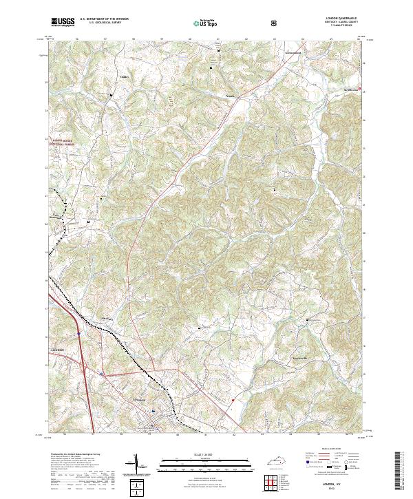
2022 Map of London
USGS Topo · Published 2022About this map
The Laurel County Judicial Center stands as a focal point in this survey of London and its northern surroundings in Laurel County. The landscape is defined by the winding course of the Little Laurel River and the South Fork Rockcastle River, which carve through the terrain near smaller settlements like Maplesville and McWhorter. To the northwest, the map documents the areas of East Bernstadt and Pittsburg, showing the transition from the city center to more rural areas and the edges of the Daniel Boone National Forest. Genealogists and local historians will find numerous small burial grounds noted, such as Mount Carmel Cem, Litton Cem, and Old Salem Cem, which offer physical links to the early families who settled this part of the Cumberland Plateau. The density of stream branches like Slate Lick and Watkins Br illustrates the well-watered topography that influenced the placement of these historic Kentucky communities.
Find a feature on this map
158 named features on this map. Tap any name to fly to it.
Don’t see what you’re looking for? This feature index may not catch every label — zoom into the map to look around manually.
Map Details
Editions of this 2022 London Map
This is the sole edition of this map. No revisions or reprints were ever made.
Historical Maps of Maplesville Through Time
5 maps found