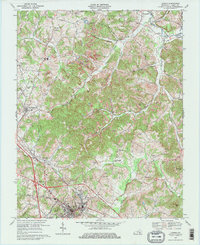
1969 Map of London
USGS Topo · Published 1977About this map
London serves as a regional hub at the intersection of the Louisville and Nashville railroad and the modern Daniel Boone Parkway. The landscape transitions from the urban center, home to Sue Bennett College, to the coal-producing hills of the Daniel Boone National Forest. To the north, industrial activity is evident in East Bernstadt and Pittsburg, where numerous mines and strip mines dot the terrain near the railroad corridor. The area's social history is preserved through scattered rural landmarks like Olive Gilead Ch, Laurel Chapel, and the Johnson Sch. The rugged eastern topography is defined by the South Fork Rockcastle River and Raccoon Creek, while historic transit routes like the Nashville Toll Road and Old Richmond Rd highlight the county's role as a vital mountain passage since the early pioneer era.
Find a feature on this map
45 named features on this map. Tap any name to fly to it.
Don’t see what you’re looking for? This feature index may not catch every label — zoom into the map to look around manually.
Map Details
Editions of this 1969 London Map
2 editions found
Other maps of this area

1891 · Manchester
USGS Topo · 1:125,000

1893 · London
USGS Topo · 1:125,000

1897 · London
USGS Topo · 1:125,000

1952 · Portersburg
USGS Topo · 1:24,000

1952 · Blackwater
USGS Topo · 1:24,000

1952 · Lily
USGS Topo · 1:24,000

1952 · London SW
USGS Topo · 1:24,000

1952 · Bernstadt
USGS Topo · 1:24,000

1952 · London
USGS Topo · 1:24,000

1953 · Livingston
USGS Topo · 1:24,000