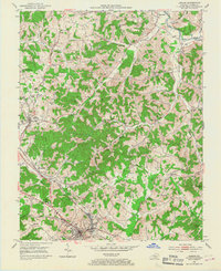
1952 Map of London
USGS Topo · Published 1967About this map
London serves as the focal point of this 1950s topographic study, showcasing the city's mid-century layout including Sue Bennett College and the State Sanatorium. The landscape is a complex intersection of natural drainage and industrial activity, characterized by the winding South Fork Rockcastle River and numerous Strip Mines that mark the hillsides. The influence of the Louisville and Nashville railroad is evident, anchoring settlements like East Bernstadt and Pittsburg to the regional coal and timber corridors.
Find a feature on this map
52 named features on this map. Tap any name to fly to it.
Don’t see what you’re looking for? This feature index may not catch every label — zoom into the map to look around manually.
Map Details
Editions of this 1952 London Map
2 editions found
Other maps of this area

1891 · Manchester
USGS Topo · 1:125,000

1893 · London
USGS Topo · 1:125,000

1897 · London
USGS Topo · 1:125,000

1952 · Portersburg
USGS Topo · 1:24,000

1952 · Blackwater
USGS Topo · 1:24,000

1952 · Lily
USGS Topo · 1:24,000

1952 · London SW
USGS Topo · 1:24,000

1952 · Bernstadt
USGS Topo · 1:24,000

1952 · London
USGS Topo · 1:24,000

1953 · Livingston
USGS Topo · 1:24,000